3 unexpected uses for drones
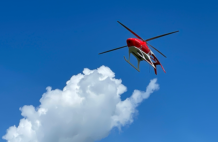
It's a bird, it's a plane, it's a drone at work! Maybe it's filming overhead videos for Instagram, part of the latest showdown of the world's fastest camera drone and an F1 car, or even capturing some great campus views #HereAtSAIT, but how else is RPAS technology being applied?
At SAIT, the Applied Research and Innovation Services (ARIS) hub is finding new ways to use remotely piloted Aircraft Systems (RPAS), and the benefits are stacking up - among them, improved safety in hazardous and remote areas, expanded data collection and new perspectives.
"Combining new RPAS technology - beyond visual line-of-sight operation, heavy payload lift, improved stability and increased range - with things like advances in sensors, image accuracy, data analysis and telemedicine has led to incredible innovation in multiple areas," says Wade Hawkins, Research Chair, Centre for Innovation and Research in Unmanned Systems (CIRUS). "By tapping into the cross-disciplinary environment of the ARIS hub and SAIT, our research teams are uncovering solutions across diverse industries."
Each 'mission' that an RPAS embarks on takes us in a new and different direction - from improved medical care in remote communities to a new perspective on inspections and rescue, and then on to techniques to generate more accurate water depth generation, providing safer measurement and enhanced flood risk modelling inputs.
Mission: Medical delivery and support
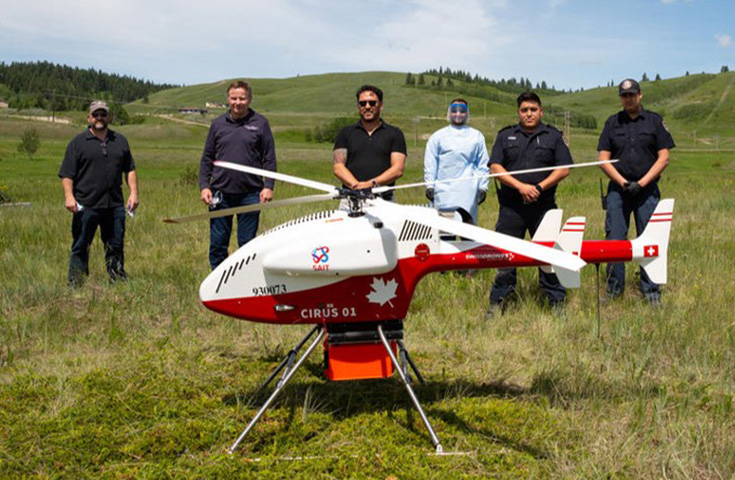
Capable of lifting up to 45 kilograms, this RPAS is used as part of a joint research project to improve medical service for Indigenous communities and remote access sites. Researchers from ARIS' Centre for Innovation and Research in Unmanned Systems (CIRUS) and W21C, a research and innovation initiative based in the University of Calgary and the Calgary Zone of Alberta Health Services, began the project during the COVID-19 pandemic to test the delivery of PPE and test kits to remote communities, as well as their safe return for testing.
The latest stage of the project included delivering an emergency medical treatment (Stop Bleed Kit) to a naïve volunteer. The drone was able to deliver the kit within reachable distance of the volunteer, who then unpacked the kit, set up a phone to connect with a remote medical mentor and successfully treated the injury. The combination of RPAS medical delivery and remote communication support could improve outcomes for those living in Indigenous communities and remote access sites.
Mission: Inspection and rescue
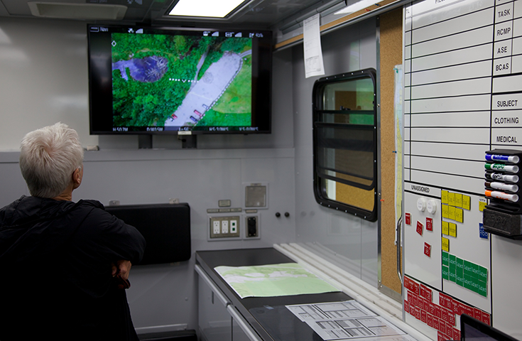
Smaller drones supporting first-person point-of-view (POV) orientation offer a more immersive viewing experience for drone operators. CIRUS uses smaller drones with POV capacity regularly to improve situational awareness in missions using larger drones, like identifying debris around storm ponds (that could entangle the tether for the sensor and disrupt the mission) or hazardous power lines. With this information, operators can identify hazards before launching larger drones, ensuring successful projects.
POV drones can also improve safety for humans. Those involved with rescue and relief efforts who may otherwise have to access compromised structures or remote areas can get a lay of the land with drone footage. The drones have different views, including visual imagery, video and thermal views, enabling search efforts to continue even through the night.
These RPAS can also be used in infrastructure inspections, like bridges, which can be difficult for inspectors to access.
Mission: Mapping below the surface
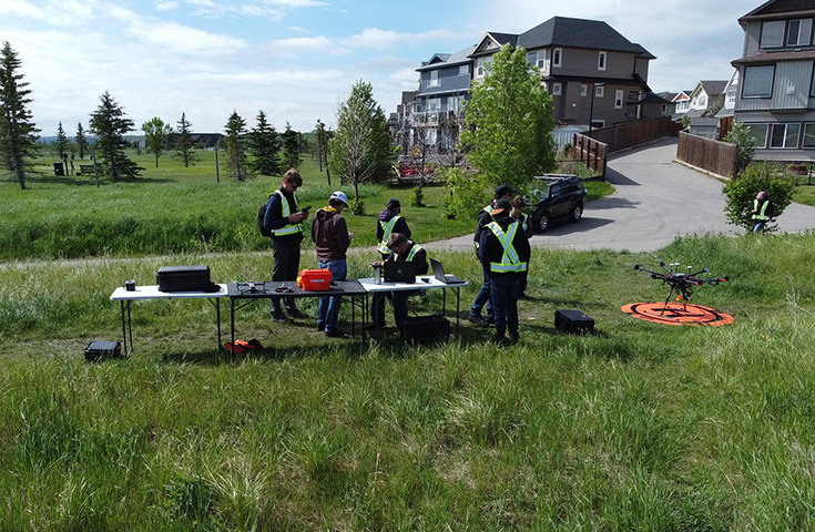
Bathymetry (pronounced buh · thi · muh · tree) is less well-know - it's the study of the underwater depth of ocean, lake and river floors to map and analyze the topography of submerged terrain. For lakes and rivers in inland BC and Alberta, the data is often collected with a device suspended from a boat.
Using RPAS for bathymetry increases safety, improves precision and provides better access to remote areas. Some sites are very remote and difficult to access or can be hazardous to human operators. The RPAS' range makes data collection possible while keeping operators out of harm's way.
During a bathymetry mission, RPAS survey the deployment site to ensure the proposed path is clear of obstacles (e.g., shrubs, powerlines, trees). This is done with a downward-facing camera that compiles a photo similar to Google StreetView, but with increased precision (instead of being precise to about 20 meters, it can be precise to within centimes!). Once the path is clear, the drone flies along the planned route with an Echologger sensor suspended beneath it. The Echologger sits just below the water's surface and can collect readings in much shallower water than boats can, allowing for more complete data in smaller bodies of water, such as lakes and ponds. The Echologger works much like adaptive cruise control in your car, with dual frequency sonar sensors gauging distance constantly to map the depths.
Precise devices like these have been a key factor in a storm pond monitoring project with the City of Calgary. Storm ponds collect runoff from Calgary's streets and allow for settling of pollutants over time, keeping our water systems healthier. The relatively small changes in water depth and sediment are difficult to track over time, but with the drone and the Echologger, more detail is available for analysis than with traditional methods. Accurate pond depths can help the City monitor water depths over time, providing valuable insight into the dynamic nature of the ponds. Longer term monitoring will also help to inform City management on factors such as sediment build up and changes in depth.
Industry driven — industry driver
SAIT's Applied Research and Innovation Services (ARIS) team develops new or improved technologies in response to the innovation needs of industry.
Industry Driven
We prepare students for successful careers and lives.
SAIT'S
2020-2025
Strategic plan

Oki, Âba wathtech, Danit'ada, Tawnshi, Hello.
SAIT is located on the traditional territories of the Niitsitapi (Blackfoot) and the people of Treaty 7 which includes the Siksika, the Piikani, the Kainai, the Tsuut’ina and the Îyârhe Nakoda of Bearspaw, Chiniki and Goodstoney.
We are situated in an area the Blackfoot tribes traditionally called Moh’kinsstis, where the Bow River meets the Elbow River. We now call it the city of Calgary, which is also home to the Métis Nation of Alberta.